Our Goal
The problem the Center for Environmental Inquiry is facing at the Fairfield Osborne Preserve on the Sonoma Mountain is the lack of ability to measure data about the preserve remotely. One such measurement that they wish to conduct is a study on how the presence of grazing cattle affects the soil in terms of its ability to hold water. If they wished to measure the amount of water it would require people to go out into the preserve and measure each location individually and repeatedly over time. This is completely impractical and thus limits the research that can be conducted on the preserve.
We have addressed this issue by creating a system on the preserve that allows for remote sensors to be installed in isolated locations and aggregates the data into a single location for the staff of the preserve. The sensors are measured by battery powered microcontrollers inside waterproof enclosures that use LoRaWAN to communicate wirelessly to a Raspberry Pi installed in the education center. The Pi acts as a LoRaWAN gateway and facilitates the uploading of measurement data to a website we created. By using this website, preserve staff can view the data measured in aggregate and control how frequently measurements are taken.
Marketing Requirements
The following outlines the marketing-level expectations of the system design, categorized by functionality.
View Requirements
- Node Support: The system must support a minimum of six Nodes.
- Range: Nodes must operate within a 0.75-mile radius of the Gateway.
- Autonomy: Nodes must function autonomously for three years under normal operating conditions (sensor readings and broadcasts to the Gateway every 15 minutes).
- Durability: The system must be resistant to water, dust, and potential damage from animals.
Data Collection and Management
- Data Collection Frequency: The data collection rate must be adjustable via the user dashboard, up to a maximum frequency of once every 15 minutes.
- Data Updates: The data upload rate must be adjustable via the user dashboard, up to a maximum frequency of once per data point collected.
- Data Reliability: Sensor data must be accurate and reliable.
- Data Storage:
- Sensor data must be temporarily stored on each Node in the event of communication failure.
- Aggregated data must be retained on the Gateway for as long as necessary.
User Interface and Dashboard
- Accessibility: Users must have easy access to collected data through a visualization dashboard.
- Battery Monitoring: Node battery status must be viewable via the dashboard.
- Connection Monitoring: Node connection status must be displayed on the dashboard.
- Location Tracking: The location of each Node must be accessible through the dashboard and must be able to be changed via the dashboard.
Deployment and Maintenance
- Relocatable Nodes: Nodes must be designed to allow for relocation after initial deployment.
- Documentation: The system must include a user manual detailing the normal operations of the system as well as how to maintain it in case of issues.
Engineering Requirements
The following outlines the technical expectations of the system, aligned with the marketing requirements where applicable.
View Requirements
- The system must allow communication between a minimum of six Nodes and the Gateway and allow the addition of 4 more Nodes in the future. (MR1)
- Communication must be reliable, with less than 10% packet loss when the Nodes are installed at locations not exceeding 0.75 miles away from the Gateway in hilly forested terrain such as that present on the Preserve. The LoRa signal must have a SNR of greater than -20dB as that is the lowest signal level that can be decoded by our Gateway. (MR2)
- Nodes must be able to operate continuously for three years, given data collection once every 15 minutes, data transmission once every 15 minutes, and with an average battery consumption of no more than 2.5 mAh in a day of operation. (MR3)
- The Nodes must meet IP67 rating to survive weather conditions, and external wires must be resistant to damage from animals through the use of shielding and conduit. (MR4)
Data Collection and Management
- The Nodes must sample data from their sensors autonomously at a frequency that users can change remotely through the dashboard, up to a maximum frequency of once every 15 minutes with a margin of +/- 1 minute. (MR5)
- The system must autonomously upload data collected from the Nodes to a publicly accessible dashboard website at a frequency (minimum once per day) that users can change remotely through the dashboard. (MR6)
- The moisture sensors used must be calibrated before installation, with a calibrated range measuring water tension from 10 to 75 centibars. Error must not exceed +/- 6 CB, two times the max error of the reference device. (MR7)
- If data sent to the Gateway is not acknowledged with a message back it must be stored in nonvolatile memory on the Node to ensure it is not lost. (MR7)
- The data stored on the Node’s nonvolatile memory must be transmitted to the Gateway when the connection is restored between them. (MR8)
- The data is aggregated by the Gateway and must be uploaded to a website hosting the dashboard, in addition it must be saved locally to a removable storage medium connected to the Gateway. (MR8)
- Data stored on the removable storage device must be updated with data gathered even if the connection with the website is lost. When the connection is reestablished, it must be uploaded to the server. (MR8)
- The communication between the Nodes and Gateway must be bidirectional to allow for verification of data receipt and reconfiguration. (MR6)
User Interface and Dashboard
- The data collected from the sensors must be available to users as a graph on the dashboard. The graphs must be able to show individual data from single Nodes as well as aggregated data from all of them. (MR9)
- The battery status of all of the Nodes must be available to users as graphs on the dashboard to allow for monitoring of the battery level remotely. (MR10)
- Battery status must be recorded with data collection from the sensors and be transmitted to the Gateway at the scheduled times. (MR10)
- The status of the connection between the Nodes and the Gateway must be available to users of the dashboard. If data is not transmitted from a Node when it was expected, the Node will be flagged as having been disconnected. (MR11)
- The status of the connection between the Nodes and the Gateway must be available to be monitored by users of the Dashboard, recording the last time a message was received from each Node. (MR11)
- The Nodes must be able to be shown at their location on a map to allow users to easily tell which Node’s data corresponds to the location of the Nodes as they were installed. (MR12)
Deployment and Maintenance
- The location of each Node must be stored in the database of connected Nodes and be able to be changed by users of the dashboard to allow for reuse of devices and moving them while preserving the data. (MR13)
- The Nodes must be able to be installed by users with minimal tools and knowledge required to allow for easy reuse, movement, or expansion of the system. (MR13)
- The Nodes must be able to indicate to users installing them that they are connected to the network without requiring users to look at the dashboard or any other devices. (MR13)
- The system must have documentation made available to users including instructions on how to install Nodes, how to troubleshoot connection issues, and how to use the dashboard to access and manipulate data. (MR14)
Our Results
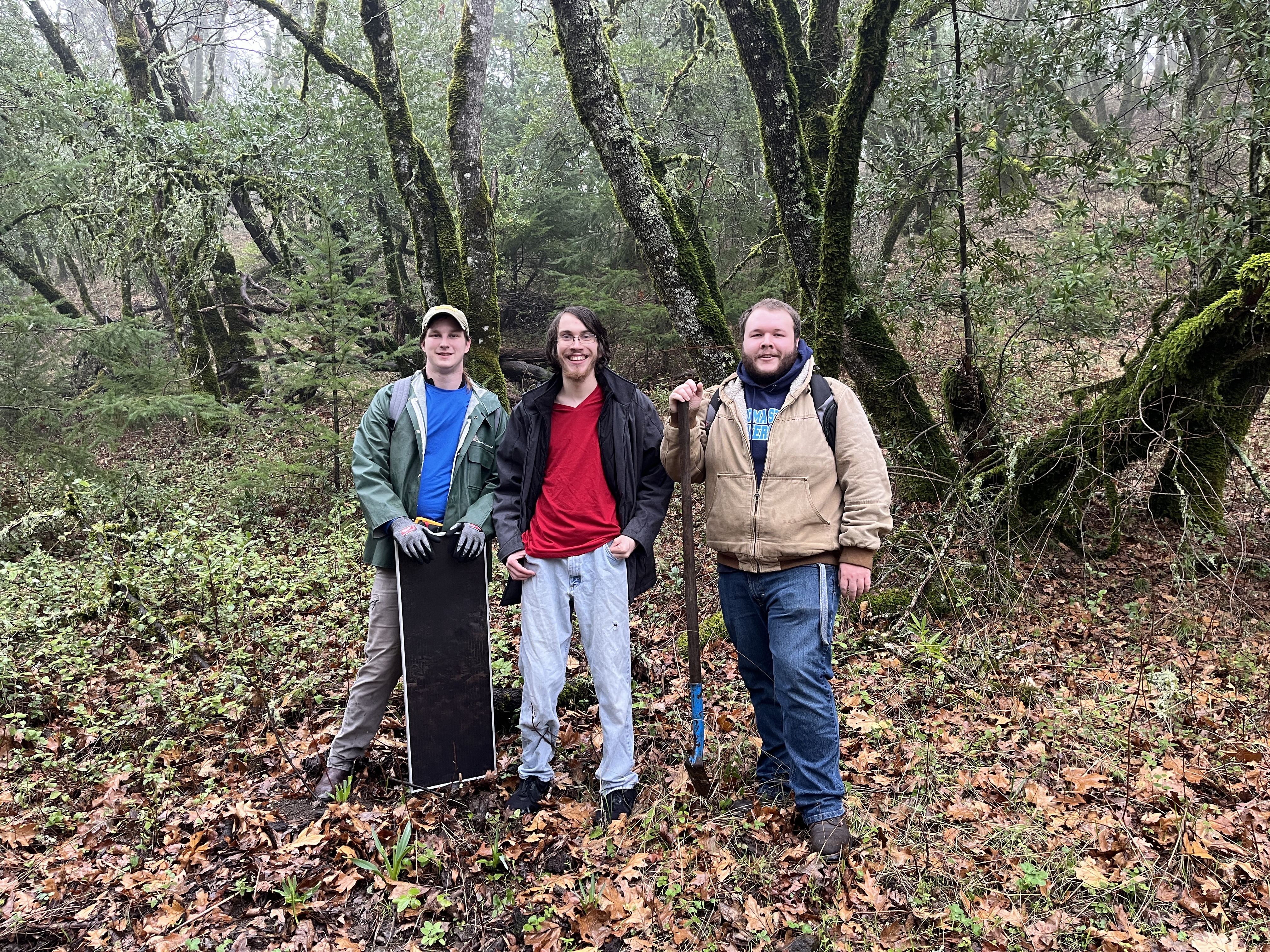
Our system was installed on the Fairfield Osborne Preserve on the 19th of April, 2025.
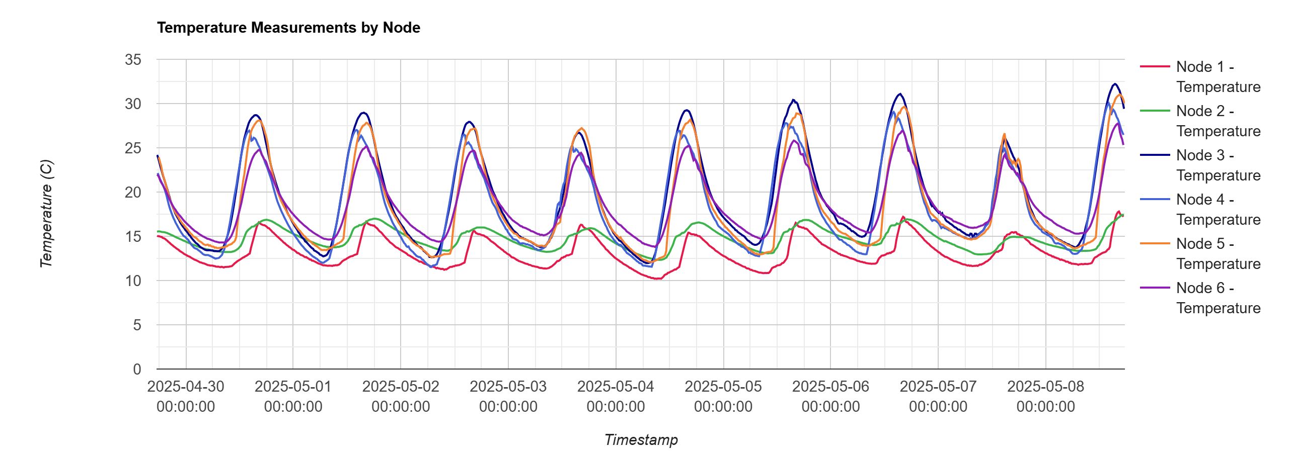
Our website aggregates data collected from the sensors and provides a graph of values to the user such as the image above.